
Hurnville, Texas
Hurnville, Texas | |
|---|---|
 Hurnville  Hurnville | |
| Coordinates: 33°57′31″N 98°10′10″W / 33.95861°N 98.16944°W | |
| Country | United States |
| State | Texas |
| County | Clay |
| Elevation | 922 ft (281 m) |
| Time zone | UTC-6 (Central (CST)) |
| • Summer (DST) | UTC-5 (CDT) |
| Area code | 940 |
| GNIS feature ID | 1379979[1] |
Hurnville is an unincorporated community in Clay County, Texas, United States.[1] According to the Handbook of Texas, the community had a population of 15 in 2000. It is located within the Wichita Falls metropolitan area.
History[edit]
Hurnville was established in 1890, and within a few years, newly arrived Russians with German ancestry made up the majority of the population. The settlement was served by a post office from 1891 to 1905, and in 1894, the German Baptist church was founded by the immigrant residents. Hurnville had 22 businesses and 20,000 residents in 1936. The population did not change, but by the middle of the 1960s, there were no local companies left. In 1990, the population numbered 15. That number did not change in the year 2000.[2]
Geography[edit]
Hurnville is located at the intersection of Farm to Market Roads 1197 and 2332, 8 mi (13 km) north of Henrietta in north-central Clay County.[2]
Education[edit]
The Hurnville area is served by the Henrietta Independent School District.
References[edit]
Municipalities and communities of Clay County, Texas, United States | ||
|---|---|---|
| Cities | 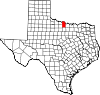 | |
| Town | ||
| Unincorporated communities | ||
| Ghost towns | ||
| Footnotes | ‡This populated place also has portions in an adjacent county or counties | |
 | This article about a location in Clay County, Texas is a stub. You can help Wikipedia by expanding it. |